
 |
Upper Mississippi River Restoration ProgramLong Term Resource Monitoring |
|
 |
||
Bathymetric data for the Upper Mississippi River System |
||
|
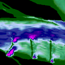
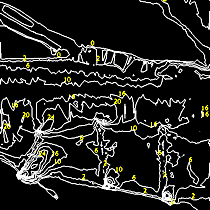
The Long Term Resource Monitoring element has overseen the collection, processing, and serving of bathymetric data since 1989. Systemic data collection was completed in 2010. An overview of bathymetric mapping by UMESC can be found in the Project Status Report "Bathymetry Data for the Upper Mississippi River" (.pdf format). Bathymetric data are collected with an automatic survey system and processed in a Geographical Information System (GIS). Through interpolation the individual points of water depth are converted into a water depth map. GIS data are downloadable through UMESC's Navigation Pool Data web pages. Similar GIS data can be produced upon request, as time allows, for specific areas needed for research studies or habitat project planning and assessment.
Contact: Questions or comments may be directed to Jayme Strange, Upper Midwest Environmental Sciences Center, La Crosse, Wisconsin, at jstrange@usgs.gov. |


Page Last Modified: October 12, 2021