
 |
Upper Mississippi River Restoration ProgramLong Term Resource Monitoring |
|
| |
||
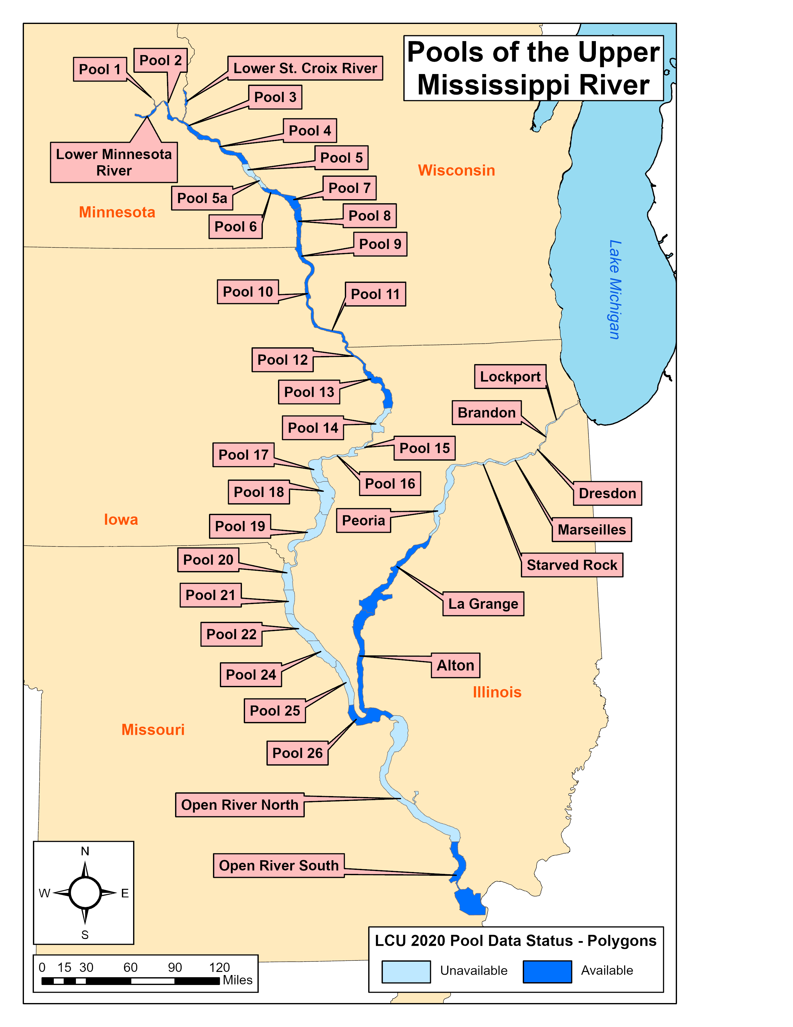
Land Cover/Use
Data
2020 Land Cover/Use - created by - |
|
Data are available for the following areas:
|
Mississippi River
|
Illinois River
|
St. Croix River | ||
|
||||

Page Last Modified: September 11, 2024