
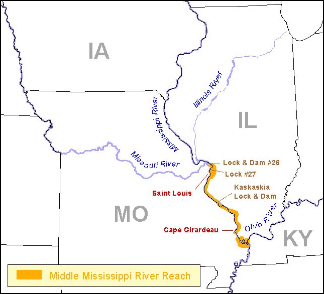
Middle Mississippi River Decision Support SystemThe Middle Mississippi River is described as the section of the Mississippi River between the confluence of the Missouri and Ohio rivers (Figure 1). The Middle Mississippi River and its floodplain have been substantially modified to accommodate multiple human uses that include urban development, navigation, and agriculture. Consequently, policy makers in state and federal agencies frequently face difficult decisions regarding management of biological resources in the river. The Middle Mississippi River Decision Support System (MMRDSS) provides a framework to assist decision makers regarding natural resource issues in the Middle Mississippi River floodplain. The MMRDSS is designed to provide users with a spatially explicit tool for tasks such as inventorying existing knowledge, developing models to investigate the potential effects of management decisions, generating hypotheses to advance scientific understanding, and developing scientifically defensible studies and monitoring. To facilitate development of the Decision Support System (DSS), an interagency workshop was held in Cape Girardeau, Missouri in February 2002. The workshop focused on hydrologic and other system drivers of aquatic habitats and their role structuring aquatic habitats and habitat connectivity. Workshop participants identified GIS data themes that might be useful for addressing key aquatic resource issues in the Middle Mississippi River such as pallid sturgeon, habitat restoration, habitat connectivity, and ecologically meaningful classification systems for large rivers.
Jason J. Rohweder1, Steven J. Zigler1, Steven N. Hulse2, and Timothy J. Fox1 1U.S. Geological Survey 2Department of Fisheries and Wildlife Sciences |
||||||
Page Last Modified: April 17, 2018