

Upper Midwest Environmental Sciences Center
Graphical Fish Database Browser Help Page
Help Topics
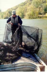
For more information on the Long Term Resource Monitoring Program (LTRMP) Fish Component monitoring procedure: LTRMP Procedures: Fish Monitoring
|
Help Using Graphical Fish Database Browser About the Graphical Fish Database BrowserThe graphing software used for the Graphical Fish Database Browser was written using Java Applet technologies. To work on your computer, your Web browser must have java enabled. The graphing software displays data for the six LTRMP field stations at the same time. The user then can choose one of the six graphs to be displayed in more detail in the main window. The software also allows for printing and for creating a comma-delimited text document of the data that can be saved to the user's computer. Using the Graphical Fish Database Browser
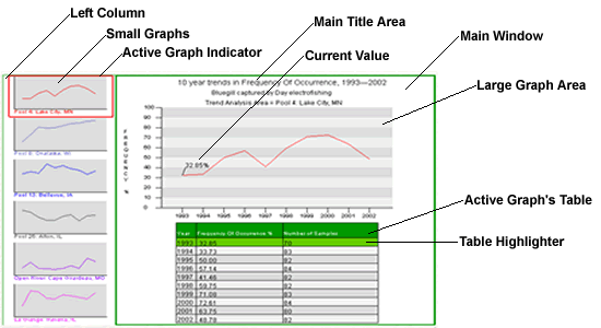
Above is a display of output from the graphing tool. The display is divided into two regions, the left column and the main window. In the left column, six small graphs (one for each field station) are displayed. The main window displays the active graph and its associated data table. To change the active graph, point the mouse arrow at the smaller version of the graph in the left column. This will highlight the chosen graph, displaying it in the main window. To see a numerical value on the graph in the main window, use the mouse to point to the location on the graph that you want to see the value for, or point to a specific year or value in the table. To print a graph, use the dialog box below the main window (shown here):
Select which graphs you wish to print by checking the small box to the left of each field station name. The default setting has all six boxes checked. Now click on the "Printer Friendly Page" button. The selected graphs will be displayed in a new window. Within this new window, click the print icon of your browser and the graphs will be printed, one per page. You may be able to print from the main window, but results are unpredictable depending on the browser and printer used. Another feature provided on the main window is the ability to create a comma-delimited text document by clicking the link below the printing information. This will open a new window containing a text document with header information followed by the data for all six field stations. You will have to save this page by clicking the "file" menu followed by "save as". Give the file a name and location to be saved then change the file type from .html to .txt and click "save". You can import the comma-delimited text file into other applications for custom graphing or statistical analysis. Enabling Java in Netscape and Internet Explorer Internet Explorer
Netscape Navigator
|
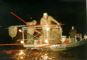
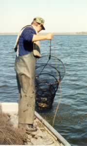
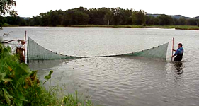
Help With Gears
|
||||||||||||||||||
Help With StrataThe LTRMP stratifies fish sampling across eight strata, characterized
by enduring geomorphic and physical features(Wilcox
1993). The LTRMP fish sampling strata are defined as follows: Main Channel Border-UnstructuredAquatic areas between the margins of the main navigation channel and
the nearest shoreline (island or mainland) excluding dams, lock walls,
and wing dams. Main Channel Border-Wing DamA localized portion of main navigation channel border in which a wing dam is the predominant physical feature. Wing dams are artificial structures that restrict flow to the navigation channel and are usually constructed of rock. Wing dams protrude from the shoreline and may be submerged or emergent. Fish sampling by the LTRMP is restricted to wing dams that are at least 50 m long. In addition, because of hydraulic conditions, wing dams submerged under more than 2 m of water are not sampled, and wing dams submerged under 1-2 m of water may not be sampled if current velocity over the top exceeds 0.5 m/s.
|
Frequency of Occurrence | Species List | Community Composition | Species Richness
URL: http://umesc.usgs.gov/data_library/fisheries/graphical/fish_database_help.html

Page Contact Information: Contacting the Upper Midwest Environmental Sciences Center
Page Last Modified: September 1, 2010