
Terrestrial Wetland Global Change Research Network
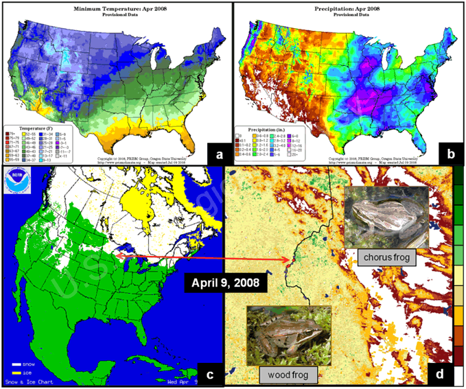
Fig. 9. A pictorial example of the relationships we are measuring annually between (a) temperature, (b) precipitation, (c) snow/ice cover, (background of d) the Normalized Difference Vegetation Index (NDVI), and (d) the onset of animal calling (e.g., the wood frog and chorus frog) at the St. Croix National Scenic Riverway research node. We produced the NDVI image (d) via NDVI-transformed data from the MODIS sensor provided as part of the eMODIS product line developed by the Earth Resources Observation and Science Center (ftp://emodisftp.cr.usgs.gov/eMODIS/CONUS). The legend on the right side of d depicts a range of NDVI values from no vegetation or a bright surface (white) to vigorous vegetation (green). We obtained the date of first frog calls (d) from acoustic recordings at the site, maps of temperature and precipitation (a, b) from PRISM (http://www.prism.oregonstate.edu/), and the snow/ice map (c) from the National Climatic Data Center (http://www.ncdc.noaa.gov/snow-and-ice/).
Page Last Modified: April 3, 2018