
|
PSR 2003-01 December 2003 Graphical Fish Database Browser for Synthesized Long Term Resource Monitoring Fisheries Databy Brian S. Ickes1, Ben Schlifer2, David Hansen1, Andy Bartels3, and Jennifer Sauer1 |
|||
|
Problem The Long Term Resource Monitoring Program (LTRMP) is the Nation’s largest river monitoring program and provides the only source of standardized ecological data for natural resource management on the Upper Mississippi River System (UMRS). The program collects data on water quality, vegetation, invertebrates, and fish. One of the primary goals of the LTRMP is to provide ready access to data for managers within the UMRS Basin.
Another Way In 2002, we developed new ways to serve LTRMP data that complement existing methods. We chose to test new concepts on the LTRMP fisheries database because it is a large, complex database that provided a good test of our concepts. Since 1993, the LTRMP fish component has made more than 25,000 site visits and collected more than 3 million fish of 134 different species. These observations are spread across six study reaches and are collected using 10 different gear types and eight different sampling strata.
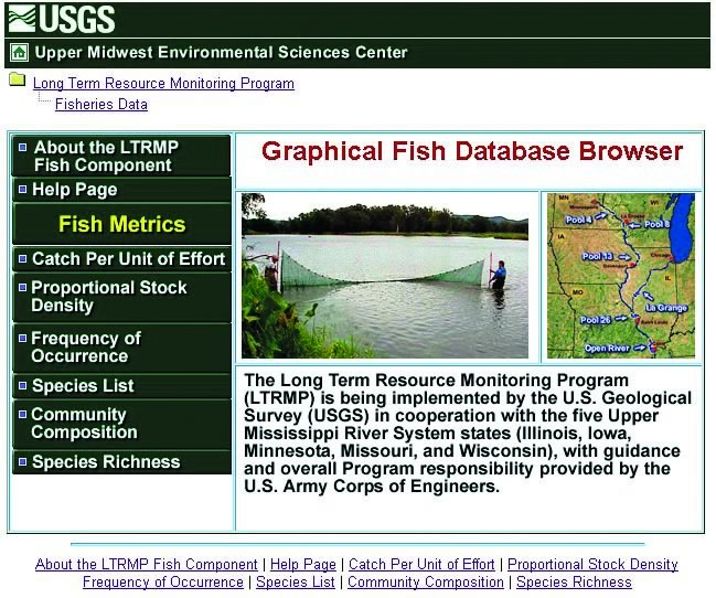
Figure 1. This is the front page of the Graphical Fish Database Browser. Here, users can learn about the Long Term Resource Monitoring Program's fish component, view a Help Page, or select which of the six population and community metrics they wish to search. Key Features Six population and community metrics are available to search (Figure 1). Population metrics focus on abundance (catch per unit effort), size structure (proportional stock density), and how often a species is collected (frequency occurrence). Community metrics focus on patterns in the individual species collected each year within a study reach (species list), comparisons of the different species collected across study reaches (community composition), and trends in the total number of species collected annually within each study reach (species richness). After the user selects a metric, a more detailed search interface is provided (Figure 2) that allows the user to select data fields from a series of three to five drop-down lists. Results of the search are provided as an interactive graphic (Figure 3), or a data table, depending on the metric selected. This Web page has many additional features including the ability to print the graphics generated, view an interactive map of the study reaches, and download a text file of the search results. These features are explained in more detail in a Help Page included with the browser (http://umesc.usgs.gov/data_library/fisheries/graphical/fish_database_help.html).
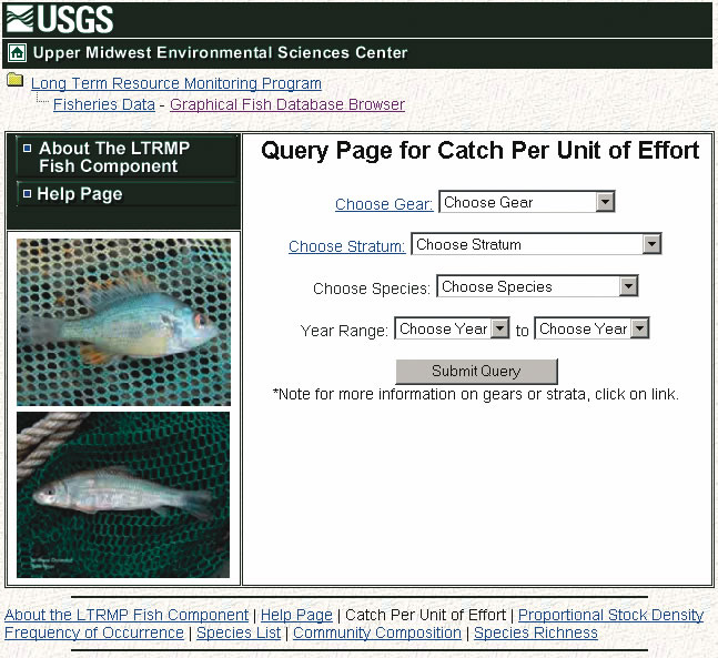
Figure 2. This is an example of a Search Page for one of the six metrics available through the Graphical Fish Database Browser (Figure 1). In this example with “Catch Per Unit of Effort,” the user simply selects a gear type, a sampling stratum, a species, and a range of years in which they are interested.
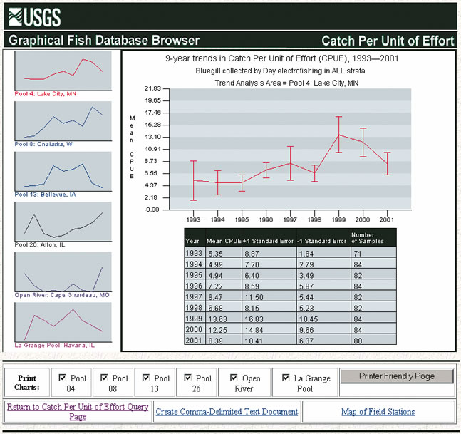
Figure 3. This is an example of the Results Page for a search
on annual estimates of catch per unit of effort for bluegill (Lepomis
macrochirus) collected by day electrofishing over all strata.
The left panel provides generalized trend lines for each of the
six study reaches. The larger plot and data table in the center
of the display contain additional detail for a specific study area
(here, Pool 4: Lake City, MN). The study area depicted changes as
the user moves the mouse pointer over the smaller plots in the left
panel. From this page, one can also generate a printer-friendly
page of results, download the actual data used to generate the results,
or view an interactive map of the study reaches with links to information
about each field station within the Program. Result The new browser helps fulfill a primary LTRMP goal of providing
ready access to monitoring data. This new tool does not replace
the former browser interface, but supplements and enhances it. Users
can still perform detailed searches on the full data set using the
old browser utility. However, the new browser allows easy access
to summarized data that can answer many common questions about the
status and trends of fishes within the UMRS. We hope to develop
similar data browsers that apply these same techniques to other
LTRMP databases soon.
|
|||
|
For further information, contact Brian S. Ickes, Dave
Hansen, or Jennifer Sauer 2Ben Schlifer 3Andy
Bartels Project Status Reports (PSRs) are preliminary documents whose purpose is to provide information on scientific activities. Because PSRs are only subject to internal peer review, they may not be cited. Use of trade names does not imply U.S. Government endorsement of commercial products. All Project Status Reports are accessible through the Upper Midwest Environmental Sciences Center's website at http://umesc.usgs.gov/reports_publications/psrs/umesc_psr.html |
Page Last Modified: April 17, 2018