
|
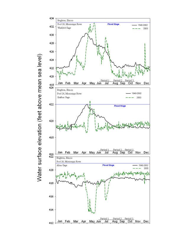
Figure 1.4 |
Daily water surface elevation from Winfield, Grafton, and Alton
|
Content manager: Jennie Sauer
October 5, 2004Page Last Modified: April 17, 2018
The .gov means it’s official.
Federal government websites often end in .gov or .mil. Before sharing sensitive
information, make sure you’re on a federal government site.
The site is secure.
The https:// ensures that you are connecting to the official website
and that any information you provide is encrypted and transmitted securely.
|
Figure 1.4 |
Daily water surface elevation from Winfield, Grafton, and Alton
|
Content manager: Jennie Sauer
October 5, 2004