
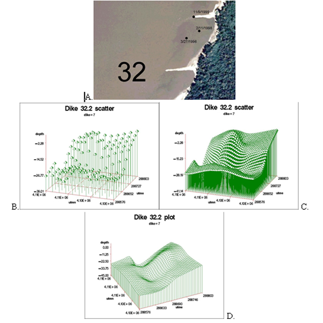
| Figure 30. | Interpolated data of approximately 100 waypoints obtained below wing dam (dike) 32.2 on the Middle Mississippi River to create a topographic image of the scour hole. |
 |
|
Page Last Modified: April 17, 2018
The .gov means it’s official.
Federal government websites often end in .gov or .mil. Before sharing sensitive
information, make sure you’re on a federal government site.
The site is secure.
The https:// ensures that you are connecting to the official website
and that any information you provide is encrypted and transmitted securely.
| Figure 30. | Interpolated data of approximately 100 waypoints obtained below wing dam (dike) 32.2 on the Middle Mississippi River to create a topographic image of the scour hole. |
|
|