
Predicting and Mapping Bird Abundances
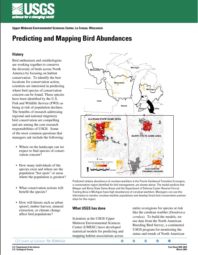
Scientists at the USGS Upper Midwest Environmental Sciences Center (UMESC) have developed statistical models for predicting and mapping habitat associations across entire ecoregions for species at risk like the cerulean warbler (Dendroica cerulea).To build the models,we use data from the North American Breeding Bird Survey, a continental USGS program for monitoring the status and trends of North American bird populations.
|
 |
||||
Web site |
|||||
Page Last Modified: April 17, 2018