Upper Midwest Environmental Sciences Center
MACROINVERTEBRATE LIABILITY DISCLAIMER AND FORMAT DESCRIPTION
Disclaimer
These data have been generated by State agencies under contract with the
Department of the Interior and the Upper Midwest Environmental Sciences Center
(UMESC). Although these data have been processed successfully on a computer
system at the UMESC, no warranty, expressed or implied, is made regarding the
accuracy or utility of the data on any other system or for general or
scientific purposes, nor shall the act of distribution constitute any such
warranty. Error correction is a continuing process, and UMESC corrects data
data errors routinely when a correct value can be determined. UMESC does not
delete questionable data when the correct value cannot be determined, but
attempts to mark such data with an appropriate flag. Users are strongly
cautioned to check the accuracy of any data obtained and to report suspected
values to UMESC. Methods, purposes, and conditions can vary dramatically
among data-collecting efforts and these data should not be combined with other
datasets from the UMESC or other sources unless the user fully understands the
procedures and purposes used to create each set of data and can verify that
data are comparable across sources.
-------------------------------------------------------------------------------
Crediting Language
These data are a product of the U.S. Army Corps of Engineers' Upper Mississippi
River Restoration Program (UMRR) Long Term Resource Monitoring (LTRM) element
implemented by the U.S. Geological Survey in collaboration with the five
Upper Mississippi River System (UMRS) states of Illinois, Iowa, Minnesota,
Missouri, and Wisconsin. The U.S. Army Corps of Engineers (Corps)
provides guidance and has overall program responsibility.
-------------------------------------------------------------------------------
MACROINVERTEBRATE TREND ANALYSIS DATA
Annual macroinvertebrate monitoring on the Upper Mississippi River System
(UMRS) was implemented in 1992 under the Long Term Resource Monitoring Program
(LTRMP). Mayflies (Ephemeridae), fingernail clams (Sphaeriidae), and the
exotic Corbicula species were selected for monitoring. Midges (Chironomidae)
were added to the monitoring scheme in 1993, with the addition of zebra
mussels (Dreissena polymorpha) in 1995. Mayflies, fingernail clams, and
midges, found in the soft-sediment substrate, were chosen because they play an
important ecological role in the UMRS. The exotic Corbicula species and zebra
mussel were chosen for sampling because of possible detrimental impacts they
may have on the economy and biology of the UMRS.
-------------------------------------------------------------------------------
FOREWARD
Use of LTRMP Trend Data for Macroinvertebrate Monitoring
The sampling design for macroinvertebrates is relatively simple; however, all
potential users of these data are strongly encouraged to read and understand
the Macroinvertebrate Monitoring section of the LTRMP Procedures Manual (Thiel
and Sauer 1999), which describes current procedures, before undertaking any
analysis or interpretation of data. This document is accessible by request
from:
Macroinvertebrate Coordinator
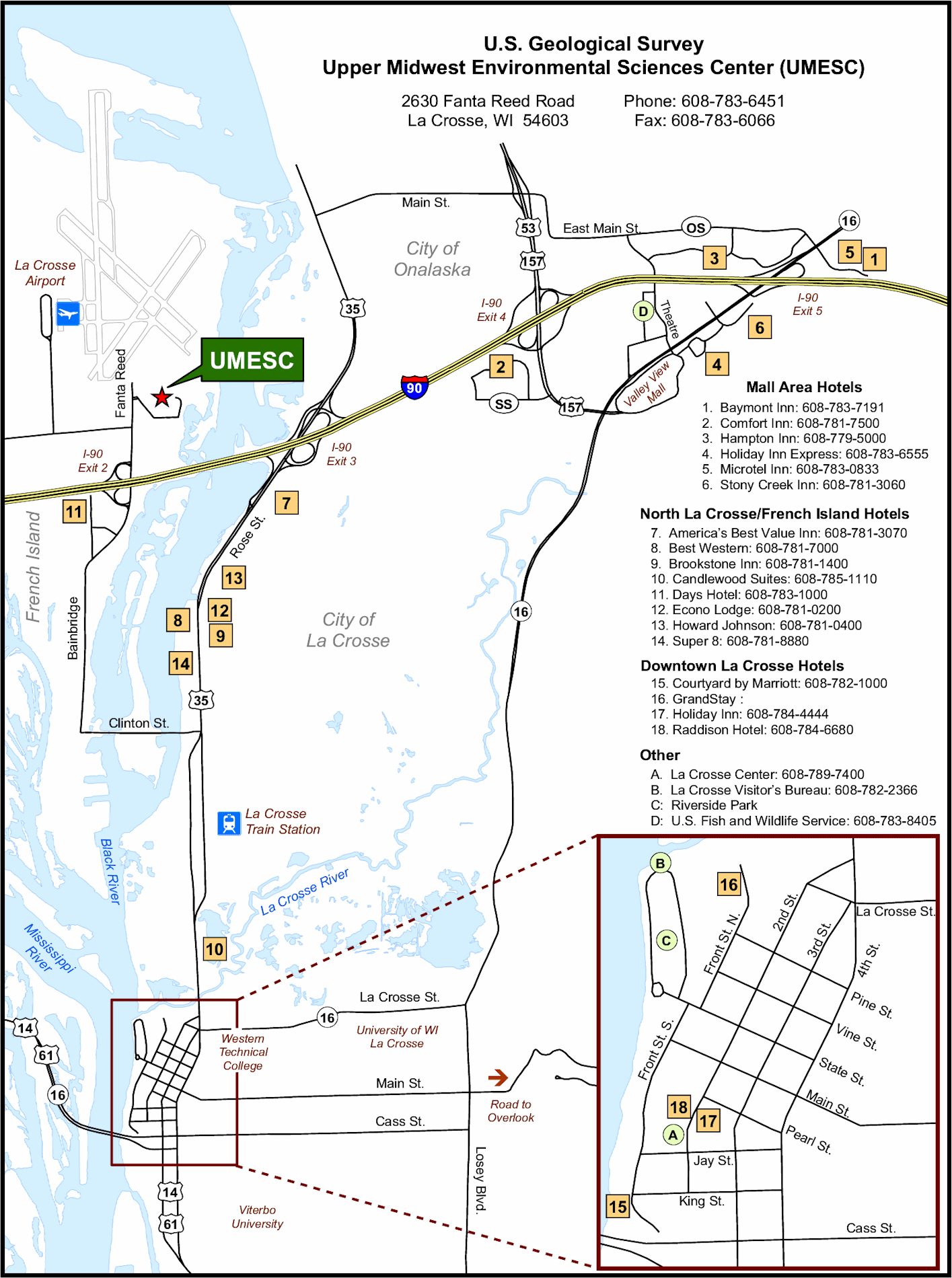
Upper Midwest Environmental Sciences Center
U.S. Geological Survey
2630 Fanta Reed Road
La Crosse, WI 54603
USA
Tel: (608) 783-7550, ext. 64
Fax: (608) 783-8058
-------------------------------------------------------------------------------
SUMMARY
LTRMP Macroinvertebrate Sampling Design
The LTRMP conducts annual monitoring of macroinvertebrates in six study areas
of the Upper Mississippi River System: Navigation Pools 4, 8, 13 and
26, and an unimpounded reach near Cape Girardeau, Missouri, on the Upper
Mississippi River; and La Grange Pool on the Illinois River. The LTRMP
conducts highly standardized macroinvertebrate sampling in main channel
border, side channel, contiguous (to the main channel or side channels)
backwater, and impounded aquatic areas in each study areas. Sampling is
conducted using a standard Ponar grab dredge (Wildlife Supply Company,
Saginaw, Michigan).
Sampling is based on a stratified random design and is conducted at
approximately 125 sites in each study reach. The aquatic areas serve a
strata. Sites include a few locations where benthic samples were collected
historically. Each field station is required to conduct macroinvertebrate
sampling at the same time each year, prior to mayfly emergence.
-------------------------------------------------------------------------------
REFERENCES
Thiel, P. A., and J. S. Sauer. 1999. Long Term Resource Monitoring Program
Procedures: Macroinvertebrate Monitoring. U.S. Geological Survey,
Upper Midwest Environmental Sciences Center, La Crosse, Wisconsin,
Revised May 1999. LTRMP 95-P002-2 (Revised 1999) 7pp. + Appendixes A-H.
-------------------------------------------------------------------------------
MACROINVERTEBRATE FIXED FORMAT FILE DOWNLOAD FILE
The fixed format file has all the data aligned to a specific column within the dataset.
Every field will start and end exactly in the same location. No field names are specified
in this format.
-------------------------------------------------------------------------------
THE "FORMAT" COLUMN CONTAINS THE FOLLOWING FORMAT SPECIFIERS:
"a": alpha character (always UPPER case);
"b": a blank space;
"blank": a missing value;
"c": alpha character/symbol/digit;
"c(xx)": character string where xx represents
the maximum number of characters allowed;
"9": any digit, 0 - 9;
"MM/DD/YYYY": date format;
-------------------------------------------------------------------------------
Field Name Short Name Format Value Range/Default Value Historical Info
--------------------------------------------------------------------------------
BARCODE BARCODE 99999999 0 - 99999999 1993 TO 2004
SAMPLE_GRID_NUMBER GRID 99999 1992 TO 2004
DATE_ONLY DATE MM/DD/YYYY 05/01/1992 - Current Date 1992 TO 2004
PROJECT_CODE PROJCODE a-999 1992 TO 2004
FIELD_STATION_NUMBER FIELDSTA 9 0,1,2,3,4,5,6 1992 TO 2004
HABITAT_CLASS HABCLASS aaa-a (See Appendix) 1992 TO 2004
RIVER_MILE RM c99.9 1993 TO 2004
SUBSAMPLE_TAKEN SUB c N,A,B 1994 TO 2004
'15' ZONE15 99 15,16 1992 TO 2004
ZONE15_EAST_WEST EUTM15 999999 1992 TO 2004
ZONE15_NORTH_SOUTH NUTM15 9999999 1992 TO 2004
EMTC_UTM_ZONE EMTCZONE 99 15,16 1992 TO 2004
EMTC_UTM_EASTING EUTMEMTC 999999 1992 TO 2004
EMTC_UTM_NORTHING NUTMEMTC 9999999 1992 TO 2004
FIELD_UTM_ZONE FLDZONE 99 15,16 1992 TO 2004
FIELD_UTM_EASTING EFIELD 999999 1992 TO 2004
FIELD_UTM_NORTHING NFIELD 9999999 1992 TO 2004
FIELD_GPS_PDOP PDOP 99.9 0 - 99.9 1992 TO 2004
WATER_DEPTH DEPTH 99.9 0 - 99.9 1992 TO 2004
NUMBER_CONTAINERS NOCONT 99 1 - 99 1993 TO 2004
REPLICATE_A_CONTAINERS REPA 9 1 - 9 1992 TO 1992
REPLICATE_B_CONTAINERS REPB 9 1 - 9 1992 TO 1992
REPLICATE_C_CONTAINERS REPC 9 1 - 9 1992 TO 1992
SUMMARY_CODE SUMCODE 9 1,2,3 1992 TO 2004
GEAR_CODE GEAR a (See Appendix) 1992 TO 2004
LAB_SAMPLE_TAKEN LAB a Y,N 1992 TO 2004
SUBSTRATE_SAMPLE_TAKEN SUBSAMPL a Y,N 1992 TO 1992
PCT_SUBMERSED_FLOAT_LEAF_VEG SUBANDFL 9 0,1,2,3,4 1992 TO 2004
SUBSTRATE_CODE SUBSTRAT 9 0,1,2,3,4,5,6 1992 TO 2004
SHELLS SHELLS c Y,N 1993 TO 2004
DETRITUS DETRITUS c Y,N 1993 TO 2004
FINE_ORGANIC_MATERIAL FINEORG c Y,N 1993 TO 2004
SITE_SUBMERSED_VEGETATION_CODE SUBMERSE 9 0,1,2,3,4 1992 TO 2004
SITE_FLOATING_LEAF_CODE FLOATING 9 0,1,2,3,4 1992 TO 2004
SITE_EMERGENT_VEGETATION_CODE EMERGENT 9 0,1,2,3,4 1992 TO 2004
SITE_OPEN_WATER OPEN 9 0,1,2,3,4 1992 TO 2004
MAYFLIES_COUNT MAYFLIES 9999 0 - 9999 1992 TO 2004
FINGERNAIL_CLAMS_COUNT FNC 9999 0 - 9999 1992 TO 2004
CORBICULA_COUNT CORBICUL 9999 0 - 9999 1992 TO 2004
MIDGES_COUNT MIDGES 9999 0 - 9999 1993 TO 2004
ZEBRA_MUSSELS ZEBRA 9999 0 - 9999 1995 TO 2004
DRAGONFLIES_DOMSELFLIES DRAGON a A,P 1998 TO 2004
STONEFLIES STONE a A,P 1998 TO 2004
CADDISFLIES CADDIS a A,P 1998 TO 2004
AQUATIC_FLIES FLIES a A,P 1998 TO 2004
FRESHWATER_MUSSELS MUSSELS a A,P 1998 TO 2004
AQUATIC_WORMS_LEECHES WORMS a A,P 1998 TO 2004
FRESHWATER_SHRIMP_CRAYFISH SHRIMP a A,P 1998 TO 2004
SCUDS SCUDS a A,P 1998 TO 2004
SNAILS SNAILS a A,P 1998 TO 2004
STATION_COMMENT COMMENTS a(80) 1992 TO 2004
RECORDER_CODE RCDCODE 9999 000 - 9999 1992 TO 2004
ENTRY_OPERATOR ENT_OPTR ccc 000 - 999 1992 TO 2001
VERIFY_OPERATOR VRF_OPTR ccc 000 - 999 1992 TO 2001
BATCH BATCH 9999 1992 TO 2004
--------------------------------------------------------------------------------
Field Positions
Field Name Position
-----------------------------------------------------------------------------
BARCODE 1:8
SAMPLE_GRID_NUMBER 9:13
DATE_ONLY 14:23
PROJECT_CODE 24:28
FIELD_STATION_NUMBER 29:29
HABITAT_CLASS 30:34
RIVER_MILE 35:39
SUBSAMPLE_TAKEN 40:40
UTM_ZONE_LITERAL 41:42
ZONE15_EAST_WEST 43:48
ZONE15_NORTH_SOUTH 49:55
EMTC_UTM_ZONE 56:57
EMTC_UTM_EASTING 58:63
EMTC_UTM_NORTHING 64:70
FIELD_UTM_ZONE 71:72
FIELD_UTM_EASTING 73:78
FIELD_UTM_NORTHING 79:85
FIELD_GPS_PDOP 86:89
WATER_DEPTH 90:93
NUMBER_CONTAINERS 94:95
REPLICATE_A_CONTAINERS 96:96
REPLICATE_B_CONTAINERS 97:97
REPLICATE_C_CONTAINERS 98:98
SUMMARY_CODE 99:99
GEAR_CODE 100:100
LAB_SAMPLE_TAKEN 101:101
SUBSTRATE_SAMPLE_TAKEN 102:102
PCT_SUBMERSED_FLOAT_LEAF_VEG 103:103
SUBSTRATE_CODE 104:104
SHELLS 105:105
DETRITUS 106:106
FINE_ORGANIC_MATERIAL 107:107
SITE_SUBMERSED_VEGETATION_CODE 108:108
SITE_FLOATING_LEAF_CODE 109:109
SITE_EMERGENT_VEGETATION_CODE 110:110
SITE_OPEN_WATER 111:111
MAYFLIES_COUNT 112:115
FINGERNAIL_CLAMS_COUNT 116:119
CORBICULA_COUNT 120:123
MIDGES_COUNT 124:127
ZEBRA_MUSSELS 128:131
DRAGONFLIES_DOMSELFLIES 132:132
STONEFLIES 133:133
CADDISFLIES 134:134
AQUATIC_FLIES 135:135
FRESHWATER_MUSSELS 136:136
AQUATIC_WORMS_LEECHES 137:137
FRESHWATER_SHRIMP_CRAYFISH 138:138
SCUDS 139:139
SNAILS 140:140
STATION_COMMENT 141:220
RECORDER_CODE 221:224
ENTRY_OPERATOR 225:227
VERIFY_OPERATOR 228:230
BATCH 231:234
--------------------------------------------------------------------------------
Field Descriptions
BARCODE
Identifying barcode for invertebrate data sheets.
SAMPLE GRID
Sample grid area for a collection site. Grid numbers are unique descriptors
for each sample site location, and are derived from a pre-determined UTM
grid system developed at UMESC.
DATE
The month, day, and year the site was sampled. Format is mm/dd/yyyy.
PROJECT CODE
Alphanumeric LTRMP project code. Format is A-nnn, where A is a letter
describing project type and nnn is a special project number. Project types are
as follows:
M = RTA standardized resource monitoring
B = HREP biological response monitoring
E = Ad hoc exploratory sampling
R = Special research project
FIELD STATION NUMBER
Numeric code identifying the field station number. Listed below are the
valid codes and their corresponding field station.
1 = Lake City, MN 4 = Brighton, IL
2 = Onalaska, WI 5 = Jackson, MO
3 = Bellevue, IA 6 = Havana, IL
HABITAT CLASS
Alphabetic code LTRMP habitat class description.
Valid codes are as follows:
BWC = Backwater contiguous
IMP = Impounded
MC = Main channel
MCB = Main channel border
SC = Side channel
TDL = Tributary delta lake (Lake Pepin only)
RIVER MILE
The location of the site to the nearest tenth of a river mile.
SUBSAMPLE TAKEN
A Code describing if a subsample was taken
Valid codes are as follows:
1994 TO 1996 only A = Large, Subsample(268 square centimeteters)
B = Small, Subsample(162 square centimeteters)
N = No, Subsample Taken
1997 - TO PRESENT Y = Yes, Subsample Taken
N = No, Subsample Taken
UTM ZONE (ZONE 15)
Numeric field to record Global Positioning System (GPS) zone.
LTRMP data resides in either zone 15 or 16. If the GPS zone = 16
the GPS zone is converted to zone 15.
UTM EASTING (ZONE 15)
East UTM (Universal Transverse Mercator) coordinates of
collection sites. This coordinate is computed at UMESC and
is then used by the collection. This is the coordinate recorded
in the field and converted to zone 15.
UTM NORTHING (ZONE 15)
North UTM (Universal Transverse Mercator) coordinates of collection sites.
This coordinate is computed at UMESC and is then used by the collection.
This is the coordinate recorded in the field and converted to zone 15.
UTM ZONE (UMESC)
Numeric field to record Global Positioning System (GPS) zone. LTRMP data
resides in either zone 15 or 16.
This zone is derived at UMESC and is then used by the collection crews
to locate where they are to do their sampling.
UTM EASTING (UMESC)
East UTM (Universal Transverse Mercator) coordinates of collection sites.
This coordinate is derived at UMESC and is then used by the collection
crews to locate where they are to do their sampling.
UTM NORTHING (UMESC)
North UTM (Universal Transverse Mercator) coordinates of collection sites.
This coordinate is derived at UMESC and is then used by the collection
crews to locate where they are to do their sampling.
UTM ZONE (FIELD)
Numeric field to record Global Positioning System (GPS) zone.
LTRMP data resides in either zone 15 or 16. This zone is derived
in the field when the collection crew can not sample the
(UMESC derived) collection site. This is the actual location
of the collection site used by the collection crews.
UTM EASTING (FIELD)
East UTM (Universal Transverse Mercator) coordinates of collection sites.
This coordinate is derived in the field when the collection crew can
not sample the (UMESC derived) collection site. This is the actual
location of the collection site used by the collection crews.
UTM NORTHING (FIELD)
North UTM (Universal Transverse Mercator) coordinates of collection sites.
This coordinate is derived in the field when the collection crew can not
sample the (UMESC derived) collection site. This is the actual location
of the collection site used by the collection crews.
ACCURACY
Numeric field to record a measure of positioning accuracy. Record Percent
Dilution of Precision (PDOP) from GPS devices and the following codes for base
map cross-reference and revisits to marked fixed sites:
00.1 = Almost certain accuracy within 100 m because of immediate proximity to
uniquely identifiable features (undisturbed marker, wing dam, day mark,
etc.).
00.2 = High confidence of accuracy within 100 m because of agreement between
general site appearance and identifiable features on a base map.
00.3 = Other than above.
DEPTH
Water depth recorded in meters.
CONTAINERS
The total number of sample containers collected at the site and taken back to
the lab (replaced # containers per replicate A, B, C in 1993).
CONTAINERS PER REPLICATE - A
The number of sample containers collected at the site and taken back to
the lab for the first sample taken at a site (applies to 1992 only).
CONTAINERS PER REPLICATE - B
The number of sample containers collected at the site and taken back to
the lab for the second sample taken at a site (applies to 1992 only).
CONTAINERS PER REPLICATE - C
The number of sample containers collected at the site and taken back to
the lab for the third sample taken at a site (applies to 1992 only).
SUMMARY CODE
A numeric code representing whether or not the sample was kept and the
circumstances surrounding the decision to accept or reject. Valid codes
are as follows:
1 = Sample taken
2 = Sample taken but not kept due to hard substrate
3 = Sample taken but not kept due to detritus, shells, etc.
4 = Other
GEAR CODE
A code representing the gear type used to collect the sample.
(P = Standard Ponar).
(E = Petite Ponar)
LAB SAMPLE TAKEN
Code if the sample was chosen for lab analysis. Valid codes are as
follows:
Y = Yes, sample chosen for lab analysis.
N = No, sample not chosen for lab analysis.
SUBSTRATE SAMPLE TAKEN
A code describing if a substrate sample was taken.
Valid codes are as follows (Applies to 1992 only):
Y = Yes substrate sample taken
N = No substrate sample taken.
% SUBMERSED AND FLOATING LEAF VEGETATION (Ponar)
This visual observation is a subjective measurement based on
the column of water and sediment the Ponar falls through. A
numeric code is recorded representing the percentage
of submersed and floating-leaf vegetation.
This field will provide data on whether or not invertebrates
associated with vegetation are in the sample and the relationship of
sites with and without vegetation.
0 = 0%
1 = 1%-20%
2 = 21%-50%
3 = 51%-90%
4 = 91%-100%
PREDOMINANT SUBSTRATE
A code to represent the qualitative observation of
sediments based on visual and tactile observations at the site.
Valid codes are as follows:
1 = Hard clay
2 = Silt/Clay
3 = Mostly silt/clay with sand
4 = Mostly sand
5 = Sand
6 = Gravel/rock
SHELLS
A code representing the percentage of dead shells in the sample
wash frame. Valid codes are as follows:
0 = 0%
1 = 1%-20%
2 = 21%-50%
3 = 51%-90%
4 = 91%-100%
DETRITUS
A code representing the percentage of detritus (fibrous
material on the surface and within the sediment) in the sample
wash frame. Valid codes are as follows:
0 = 0%
1 = 1%-20%
2 = 21%-50%
3 = 51%-90%
4 = 91%-100%
FINE ORGANIC MATERIAL
A code indicating if fine organic material (characterized by black
coloration and odor) is present in the sample.
Valid codes are as follows:
Y = Yes, fine organic material present
N = No, fine organic material not present
SUBMERSED VEGETATION
A code representing the percentage of submersed vegetation
within a 15-m radius from the boat. Valid codes are as follows:
0 = 0%
1 = 1%-20%
2 = 21%-50%
3 = 51%-90%
4 = 91%-100%
FLOATING LEAF
A code representing the percentage of floating leaf vegetation
within a 15-m radius from the boat. Valid codes are as follows:
0 = 0%
1 = 1%-20%
2 = 21%-50%
3 = 51%-90%
4 = 91%-100%
EMERGENT VEGETATION
A code representing the percentage of emergent vegetation
within a 15-m radius from the boat. Valid codes are as follows:
0 = 0%
1 = 1%-20%
2 = 21%-50%
3 = 51%-90%
4 = 91%-100%
OPEN WATER
A code representing the percentage of open water
within a 15-m radius from the boat. Valid codes are as follows:
0 = 0%
1 = 1%-20%
2 = 21%-50%
3 = 51%-90%
4 = 91%-100%
MAYFLIES
The number of mayfly larvae found in the collection sample for
the site.
FINGERNAIL CLAMS
The number of fingernail clams found in the collection sample for
the site.
CORBICULA
The number of corbicula found in the collection sample for
the site.
MIDGES
The number of midges found in the collection sample for
the site.
ZEBRA MUSSELS
The number of zebra mussels found in the collection sample for
the site (not started recording until 1995).
DRAGONFLIES DAMSELFLIES
A code representing if dragonflies or damselflies are absent (A) or
present (P) in the sample (not started recording until 1998).
STONEFLIES
A code representing if stoneflies are absent (A) or
present (P) in the sample (not started recording until 1998).
CADDISFLIES
A code representing if caddisflies are absent (A) or
present (P) in the sample (not started recording until 1998).
AQUATIC FLIES
A code representing if aquatic flies are absent (A) or
present (P) in the sample (not started recording until 1998).
FRESHWATER MUSSELS
A code representing if fresh water mussels are absent (A) or
present (P) in the sample (not started recording until 1998).
AQUATIC WORMS LEECHES
A code representing if aquatic worms or leeches are absent (A) or
present (P) in the sample (not started recording until 1998).
FRESHWATER SHRIMP CRAYFISH
A code representing if fresh water shrimp or crayfish are absent (A) or
present (P) in the sample (not started recording until 1998).
SCUDS
A code representing if scuds are absent (A) or
present (P) in the sample (not started recording until 1998).
SNAILS
A code representing if snails are absent (A) or
present (P) in the sample (not started recording until 1998).
COMMENTS
Eighty-character field to record miscellaneous comments and
observations.
RECORDER CODE
This number uniquely identifies the person who coded
the data sheet.
ENTRY OPERATOR
Alphanumeric field to identify the operator responsible for entering (keying)
the invertebrate data into an electronic format.
VERIFY OPERATOR
Alphanumeric field to identify the operator responsible for verifying the
electronic keyed invertebrate data.
BATCH NUMBER
Administrative field used to track keyed data batches.

![]() U.S. Department of the Interior |
U.S. Geological Survey
U.S. Department of the Interior |
U.S. Geological Survey
Page Contact Information: Contacting the Upper Midwest Environmental Sciences Center
