 Abstract Abstract
Public and private land managers desire better ways to
incorporate landscape, species, and habitat relations into their
conservation planning processes. We present three tools, developed for
the Environmental Systems Research Institute’s ArcView 3.x platform,
applicable to many types of wildlife conservation management and
planning efforts. These tools provide managers and planners with the
ability to rapidly assess landscape attributes and link these
attributes with species-habitat information. To use the tools, the user
provides a detailed land cover spatial database and develops a matrix
to identify species-habitat relations for the landscape of interest.
The tools are applicable to any taxa or suite of taxa for which the
required data are available. The user also has the ability to
interactively make polygon-specific changes to the landscape and
re-examine species-habitat relations. The development of these tools
has given resource managers the means to evaluate the merits of
proposed landscape management scenarios and to choose the scenario that
best fits the goals of the managed area.
CCP GIS Query Tool
The CCP GIS Query Tool (Query Tool) is an ArcView GIS extension. The Query Tool uses a wildlife species-habitat matrix that is developed specifically for an area of interest. A matrix may be prepared regionally or for a specific area, but it is up to the user to provide this information as it is not included with the software. The user may base the matrix on the entire range of wildlife species, on regional conservation priority species, or on an area-specific prioritization scheme. A recent land cover spatial database usually serves as the basis for land cover community descriptions used in the matrix. Habitat potential for each land cover type is ranked on a simple scoring scheme (e.g., 0 = no potential, 1 = low, 2 = medium, 3 = high) for each species. Scoring is based on expert opinions of staff with knowledge of species-habitat relations for the area of interest. For public lands, we encourage regional or network oversight to ensure consistency among areas while providing flexibility to meet individual differences in habitat values among areas with respect to individual species ranges.
The level of detail provided by the available spatial land cover limits the application of the Query Tool. Land cover themes are general in nature and typically do not provide information concerning the specific-habitat requirements of animal species (e.g., appropriate visual obstruction, vegetation height, litter depth, floristic composition). Consequently, some assumptions or generalizations about how well vegetation types meet specific needs of each species are required.
The Query Tool allows the user to choose from various matrices linked to specific land cover themes and was designed to quickly generate information about user-specified wildlife species or habitats for managed lands. Selections include potential species habitat, occurrence, and richness through the production of GIS themes, tables, charts, maps, and textual reports. Products generated with the Query Tool will help establish a technically sound, consensus-based management of specific areas or groups of areas.
CCP GIS Clipping Tool
The CCP GIS Clipping Tool (Clipping Tool) is an additional ArcView extension provided with the latest version of the CCP GIS Tools CD-ROM. The Clipping Tool allows the user to clip data themes and view summary statistics of the clipped region. What makes the Clipping Tool a powerful analytical tool is its ability to cut through multiple themes and compare those themes using a common attribute.
CCP GIS Edit Tool
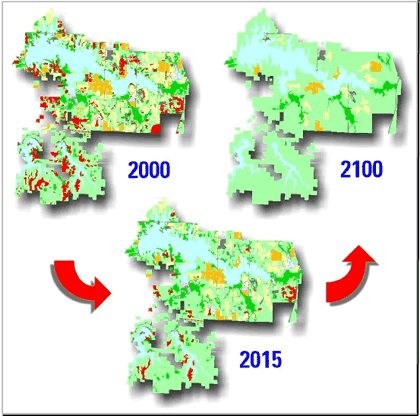
The CCP GIS Edit Tool (Edit Tool) is used to alter the land cover themes of a refuge to create depictions of future landscapes. The Edit Tool allows the user to select specific polygons for changing to a new cover type. If the new designation for the polygon matches an adjacent polygon, the border between the two is dissolved automatically, and the area is recalculated for the resulting polygon. The Edit Tool also allows for calculation of several area metrics for individual polygons as well as the entire land cover theme.
The CCP GIS Tools were developed for use in ArcView version 3.x, using the ESRI Avenue macro-language. Output from the tools can be further enhanced by using ArcView's GIS tools and by incorporating user data.
The CCP GIS Tools will NOT work within ArcMap version 8.x and above. We recommend maintaining a computer that runs ArcView version 3.x for purposes of using the CCP GIS Tools. UMESC has developed an ArcMap version 9.x conservation planning tool, LINK, that provides some of the functions of the CCP GIS Tools. The LINK tool works much the same way as the CCP GIS Tools, however it was designed to analyze large raster (ESRI GRID) datasets. Although LINK calculates potential species habitat, occurrence, and richness products for the selected landscape similar to the CCP GIS Query Tool, the CCP GIS Edit Tool and the CCP GIS Clipping Tool are not available in LINK.
Download GIS Tools for Conservation Planning:
Please direct problems downloading files to Jason Rohweder.
The CCP GIS Tools are another example of the Upper Midwest Environmental Sciences Center’s commitment to helping partners develop spatially explicit modeling, analysis, and Decision Support Systems.
Principal Investigators:Tim Fox, Kevin
Kenow, and Jason Rohweder
|
