Upper Midwest Environmental Sciences Center
Black Bay, LA100K Quadrangle Selection Tile - UMESC Aerial Photo Server |
| |||||||||
Select a 24K tile. The 24K quadrangle tiles contain links to aerial photographs.
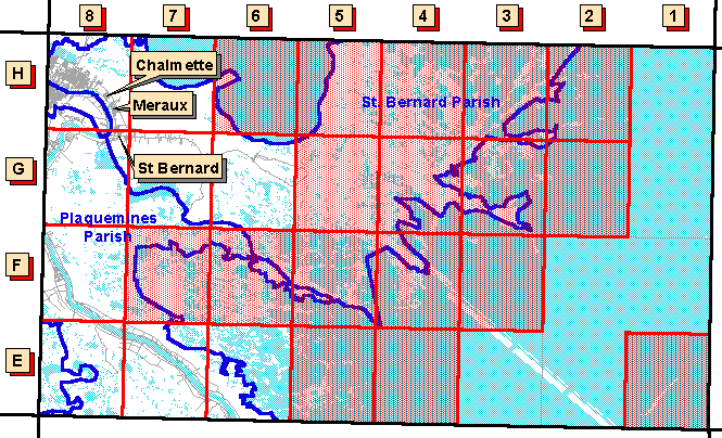
| Grid Code | 24K Quadrangle Name | 1997 Color Oblique Photos |
| E-6 | Happy Jack, LA | available |
| E-7 | Pointe a La Hache, LA | available |
| E-8 | Lake Laurier, LA | available |
| F-8 | Phoenix, LA | available |
| G-6 | Yscloskey, LA | available |
| G-7 | Delacroix, LA | available |
| G-8 | Belle Chasse, LA | available |
| H-7 | Martello Castle, LA | available |
| H-8 | Chalmette, LA | available |
Page Last Modified: April 17, 2018