Upper Midwest Environmental Sciences Center
Ponchatoula, LA100K Quadrangle Selection Tile - UMESC Aerial Photo Server |
| |||||||||
Select a 24K tile. The 24K quadrangle tiles contain links to aerial photographs.
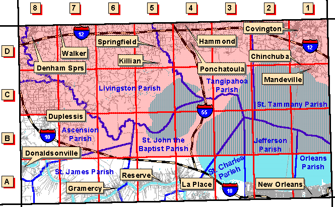
| Grid Code | 24K Quadrangle Name | 1997 Color Oblique Photos |
| A-1 | Spanish Fort, LA | available |
| A-2 | Indian Beach, LA | available |
| A-3 | La Branche, LA | available |
| A-4 | Laplace, LA | available |
| A-5 | Reserve, LA | available |
| A-6 | Lutcher, LA | available |
| A-7 | Convent, LA | available |
| A-8 | Donaldsonville, LA | available |
| B-8 | Gonzales, LA | available |
Page Last Modified: April 17, 2018