

Upper Midwest Environmental Sciences Center
Waterbird Distribution and Foraging Patterns on the Great Lakes with Respect to Avian Botulism
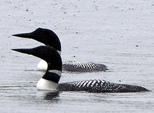
Periodic outbreaks of type-E botulism have resulted in die-offs of fish and fish-eating birds in the Great Lakes since at least the 1960s, but outbreaks have become more common and widespread since 1999. Extensive bird mortality has caused great public concern, yet the actual site of toxin exposure among birds remains unclear. The physical and ecological factors that lead to botulism outbreaks are poorly understood, but invasive species, such as dreissenid mussels and round gobies, may serve to mobilize toxin from lake-bed sediments to fish-eating water birds and other aquatic species. Central to this question are feeding patterns and exposure routes of sentinel waterbird species, such as common loons (Gavia immer), historically at risk to botulism die-offs. This study is part of a larger USGS effort to investigate the dynamics of botulinum toxin production and food web distribution of the toxin. The Upper Midwest Environmental Sciences Center (UMESC) in La Crosse, Wisconsin is studying the distribution and foraging patterns of sentinel fish-eating waterbirds through aerial surveys, and by tracking migration movements coupled with foraging depth profiles of common loons equipped with archival geo-locator tags and satellite transmitters. The results of this work are expected to elucidate where piscivorous waterbirds are likely to be exposed to forage fish carrying type-E botulinum toxin, which in turn will inform site-specific efforts to assess the degree to which physical and ecological factors contribute to the occurrence of botulinum toxin in aquatic food webs. |
|

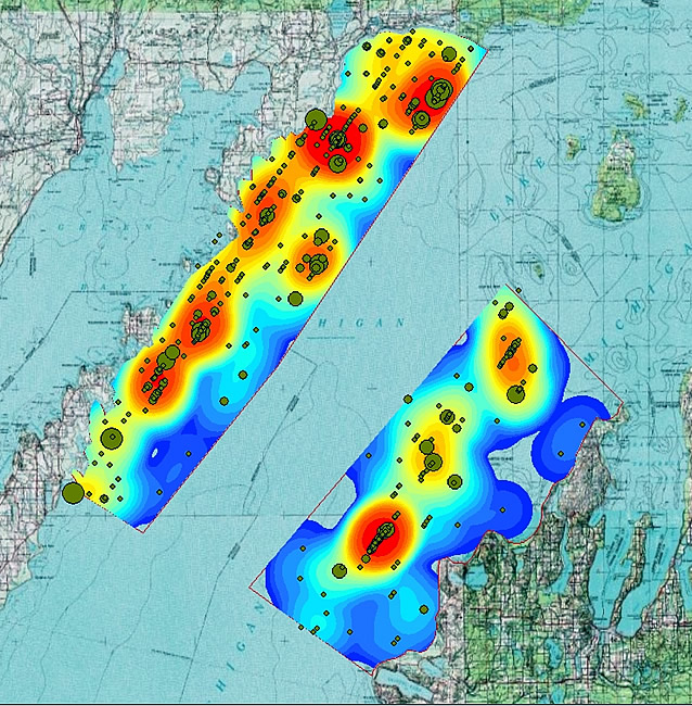
The abundance and distribution of waterbirds are determined during aerial surveys of Lake Michigan. This graphic depicts concentrations of common loons (warmer colors indicate higher densities) in survey areas that were estimated from individual common loon observations (dot size is related to number of loons observed). |
Dive profile, interpreted from geolocator tag pressure data, depicting timing and depths of individual dives of common loon on November 4, 2009 during a migration stop-over on Lake Michigan. (Click image for larger scale) |
|

Principal Investigator: Kevin Kenow
URL: http://umesc.usgs.gov/terrestrial/migratory_birds/waterbird_distribution_avian_botulism.html
Page Contact Information: Contacting the Upper Midwest Environmental Sciences Center
Page Last Modified: February 1, 2016