
 |
Upper Mississippi River Restoration ProgramLong Term Resource Monitoring |
|
| |
||
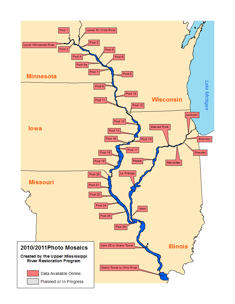
2010/11 Photo Mosaics |
Orthoreferenced Color Infrared Images
Data are available for the following
Metadata
|
Mississippi River
|
Illinois River | Other | ||
|---|---|---|---|---|
|
||||
The U.S Army Corps of Engineers’ Upper Mississippi River Restoration Program (UMRR) partnered with the U.S. Fish and Wildlife Service (USFWS) Region 3 to collect digital color infrared (CIR) aerial photography of Pools 1-13, Upper Mississippi River at 8"/pixel resolution and Pools 14 - Open River, Mississippi River and the Illinois River at 16"/pixel using a mapping-grade Applanix DSS439 digital aerial camera. The photography shall be at a minimum accuracy of 5-10 meters and allow for the development of orthorectified photo mosaics by U.S. Geological Survey – Upper Midwest Environmental Sciences Center (USGS-UMESC) for all or portions of the coverage area. The flights occurred during times of peak vegetation biomass, typically from late August through early September. The mosaics are served as orthoreferenced JPEG2000 images.

Page Last Modified: April 3, 2018