
 |
Upper Mississippi River Restoration ProgramLong Term Resource Monitoring |
|
| |
||
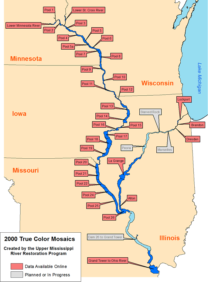
2000 Photo Mosaics |
Georeferenced True Color Images
Data are available for the following
areas - Metadata
|
|
||||||||||
In 2000 the Long Term Resource Monitoring Program collected 1:16,000-scale true color aerial photographs for the Upper Mississippi and Illinois River floodplains. Adjacent contact prints created from the 9"x9" photo transparencies were scanned at 200dpi. The photos are served as georeferenced .sid images. A free image viewer capable of subsetting, resampling, and exporting the compressed images to georeferenced TIFF images (a .tif image and a .tfw world file) is available.

Page Last Modified: April 3, 2018