
Saint Paul, MN100K Quadrangle Selection Tile - UMESC Aerial Photo Server |
| |||||||||
Select a 24K tile. The 24K quadrangle tiles contain links to aerial photographs.
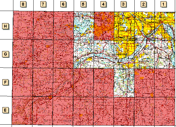
| Grid Code | 24K Quadrangle Name | 1994 Color Infrared Aerial Photographs | 1997 Color Oblique Photos |
| F-3 | Orchard Lake, MN | available | |
| G-1 | Inver Grove Heights, MN | available | available |
| G-2 | St. Paul SW, MN | available | available |
| G-3 | Bloomington, MN | available | available |
| G-4 | Eden Prairie, MN | available | available |
| G-5 | Shakopee, MN | available | |
| H-1 | St. Paul East, MN | available | available |
| H-2 | St. Paul West, MN | available | available |
| H-3 | Minneapolis South, MN | available | available |
| H-5 | Excelsior, MN | available |
Page Last Modified: April 17, 2018