Upper Mississippi River Restoration Program

Upper Mississippi River Restoration Program

Long Term Resource Monitoring


folder.gif Backwater sedimentation rates

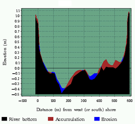
Rates and Patterns of Net Sedimentation in Backwaters of Pools 4, 8, and 13 of the Upper Mississippi River

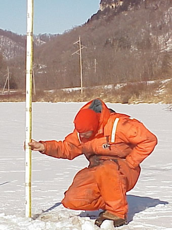
James T. Rogala, Pete J. Boma, and Brian R. Gray
U.S. Geological Survey, PO Box 818, La Crosse, Wisconsin 54603, USA

Contents

red arrow.gif rates_patterns.pdf (373 KB)

USGS scientist
sedimentation graph

Accessibility FOIA Privacy Policies and Notices

Take Pride in America logo USA.gov logo U.S. Department of the Interior | U.S. Geological Survey


Page Last Modified: May 7, 2018 US Army Corps of Engineers USGS Upper Midwest Environmental Sciences Center US Fish and Wildlife Service U.S. Environmental Protection Agency U.S. Department of Agriculture Natural Resources Conservation Service Minnesota DNR Wisconsin DNR Iowa DNR Illinois Natural History Survey Missouri DC