
Upper Mississippi River Restoration Program
Long Term Resource Monitoring

|
Upper Mississippi River Restoration ProgramLong Term Resource Monitoring |
|
| |
||
Random Landscape Tool uses a raster data source and a table of classifications to create a random landscape. The classification table allows the user to weight the probability of occurrence to certain classes and to spatially restrict the distribution of classes to certain areas (zones).
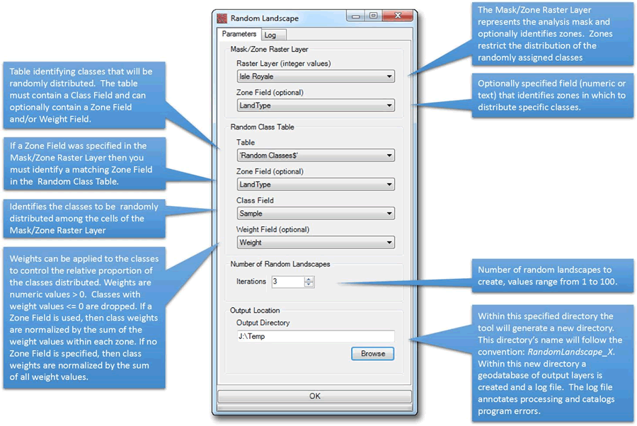
Figure 1.The Random Landscape Tool’s interface.
This tool is applicable to geo-spatial stochastic modelers who wish to randomly distribute sample data across landscape. For instance, a researcher may possess forest inventory data that describes the biometric characteristics and composition of individual tree species within a forest stand. From the inventory data, the Random Landscape Tool can distribute these data within a defined spatial boundary or set of boundaries (zones), creating a continuous landscape that remains faithful to the statistical characteristics of the sampled data. The randomly defined landscape can then be used as input into stochastic models systems like the successional models within the Landis II system.
The user inputs a classification table with forest inventory data to be distributed into zones representing the different forest types on the island (Figure 2), thus creating a representative landscape that possesses sample plot level detail. This output can then be used as input into stochastic model systems that are used to forecast potential landscape change as a response to climate change, herbivory, fire scenarios, etc.
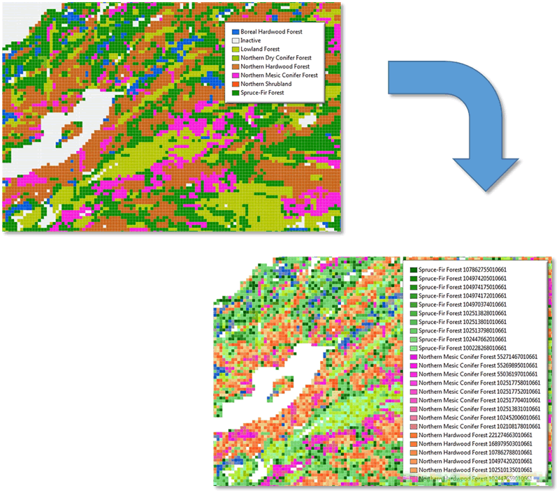
Figure 2. Raster zones used as input to the Random Landscape Tool. Output classification is symbolized as a concatenation of zone and sample (the forest inventory ID number).
