Upper Midwest Environmental Sciences Center
Carbondale, IL/MO100K Quadrangle Selection Tile - UMESC Aerial Photo Server |
| |||||||||
Select a 24K tile.
The 24K quadrangle tiles contain links to aerial photographs.
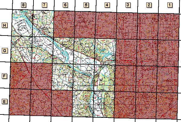
| Grid Code | 24K Quadrangle Name | 1994 Color Infrared Aerial Photographs | 1997 Color Oblique Photos |
| E-4 | Wolf Lake, IL/MO | available | |
| E-5 | Neelys Landing, MO/IL | available | available |
|
|
Gorham, IL |
|
|
| F-5 | Altenburg, MO/IL | available | available |
| F-6 | Crosstown, MO | available | available |
| G-4 | Oraville, IL | available | |
| G-5 | Raddle, MO | available | |
| G-6 |
Rockwood, IL |
available | available |
| G-7 |
Belique, MO |
available | available |
| G-8 | Lithium, MO | available | |
| H-7 | Chester, IL/MO | available | available |
| H-8 | Kaskaskia, MO/IL | available | available |
Page Last Modified: April 17, 2018