Upper Midwest Environmental Sciences Center
Dumas, AR/MS100K Quadrangle Selection Tile - UMESC Aerial Photo Server |
| |||||||||
Select a 24K tile. The 24K quadrangle tiles contain links to aerial photographs.
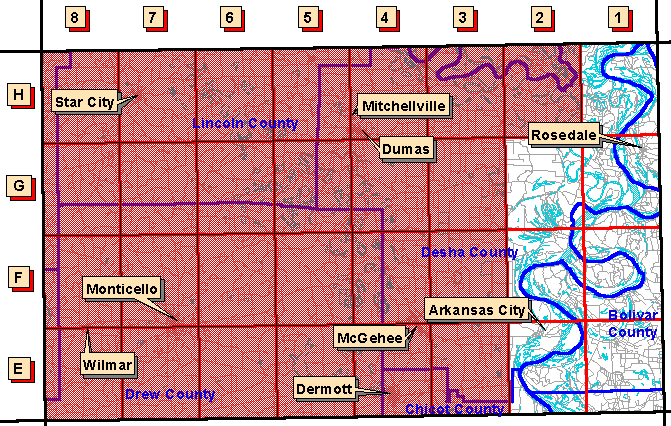
| Grid Code | 24K Quadrangle Name | 1997 Color Oblique Photos |
| E-1 | Scott, MS | available |
| E-2 | Arkansas City, AR/MS | available |
| F-1 | Benoit, MS/AR | available |
| F-2 | Catfish Point, MS/AR | available |
| G-1 | Rosedale, MS/AR | available |
| G-2 | Lake Cheatham, AR/MS | available |
| H-1 | Montgomery Island, AR/MS | available |
Page Last Modified: April 17, 2018