Upper Midwest Environmental Sciences Center
Sikeston, MO/IL/KY100K Quadrangle Selection Tile - UMESC Aerial Photo Server |
| |||||||||
Select a 24K tile. The 24K quadrangle tiles contain links to aerial photographs.
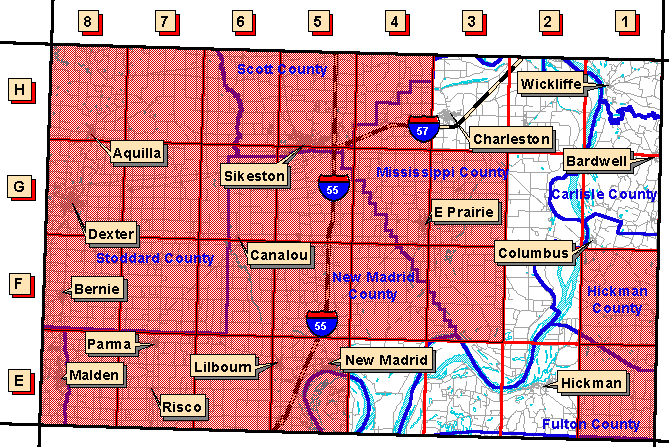
| Grid Code | 24K Quadrangle Name | 1994 Color Infrared Aerial Photographs | 1997 Color Oblique Photos |
| E-2 | Hickman, KY/MO/TN | available | |
| E-3 | Bondurant, KY/MO | available | |
| E-4 | Hubbard Lake, MO/KY | available | |
| F-2 | Wolf Island, MO/KY | available | |
| G-1 | Arlington, KY/MO | available | |
| G-2 | Wickliffe SW, KY/MO | available | |
| H-1 | Wickliffe, KY/MO | available | available |
| H-2 | Wyatt, MO/IL/KY | available | available |
| H-3 | Charleston, MO/IL | available |
Page Last Modified: April 17, 2018